


YORK WD 14 PCT 03, York County, Pennsylvania
About
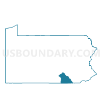
Outline

Summary
| Unique Area Identifier | 664835 |
| Name | YORK WD 14 PCT 03 |
| County | York County |
| State | Pennsylvania |
| Area (square miles) | 0.86 |
| Land Area (square miles) | 0.86 |
| Water Area (square miles) | 0.00 |
| % of Land Area | 100.00 |
| % of Water Area | 0.00 |
| Latitude of the Internal Point | 39.98181570 |
| Longtitude of the Internal Point | -76.75178260 |
Maps


Graphs
Select a template below for downloading or customizing gragh for YORK WD 14 PCT 03, York County, Pennsylvania


Neighbors
Neighoring Voting District (by Name) Neighboring Voting District on the Map
- MANCHESTER TWP DIST 07, York County, PA
- WEST MANCHESTER TWP DIST 05, York County, PA
- YORK WD 14 PCT 02, York County, PA
Top 10 Neighboring County Subdivision (by Population) Neighboring County Subdivision on the Map
- York city, York County, PA (43,718)
- West Manchester township, York County, PA (18,894)
- Manchester township, York County, PA (18,161)
Top 10 Neighboring Place (by Population) Neighboring Place on the Map
Top 10 Neighboring Unified School District (by Population) Neighboring Unified School District on the Map
- York City School District, PA (43,718)
- Central York School District, PA (37,538)
- West York Area School District, PA (23,636)
Top 10 Neighboring State Legislative District Lower Chamber (by Population) Neighboring State Legislative District Lower Chamber on the Map
- State House District 47, PA (75,494)
- State House District 196, PA (69,920)
- State House District 95, PA (65,794)
Top 10 Neighboring State Legislative District Upper Chamber (by Population) Neighboring State Legislative District Upper Chamber on the Map
Top 10 Neighboring 111th Congressional District (by Population) Neighboring 111th Congressional District on the Map
Top 10 Neighboring Census Tract (by Population) Neighboring Census Tract on the Map
- Census Tract 212.10, York County, PA (8,303)
- Census Tract 214.10, York County, PA (4,861)
- Census Tract 14, York County, PA (4,255)